TanZ
Home
Squiggly
Lines
Navigation
Store
TanZ
Events
Map
Making
Rogaine
Calendar
Adv. Racing
Resources
Email
List
Mark
Bio
The Navigation Store
X Compass Model 3 compass:
Quick setting (1 to 1.5 second), excellent stability during running, extra high power magnet, black and white scale with 2 degree graduations. Recommended for accurate azimuthal moving. It is X compass's most stable compass.
Base plate:
Select a base plate
Left
Right
Band
Center
$70
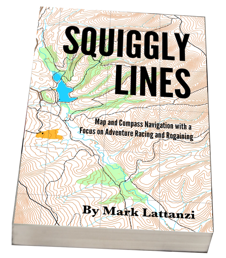
Squiggly Lines Book
:
Map and Compass Navigation for Adventure Racers
Want to learn how to hike in the woods and not get lost? Or perhaps you want to compete in a local orienteering event? Maybe you aspire to do the 10-day Eco-Challenge race?
Squiggly Lines
is a full-color book about map and compass navigation with a focus on adventure racing. The book is almost 300 pages and has
over 150 color maps and figures
and almost
100 navigation exercises
.
$27.95
Map-making Services:
I make custom topo maps for roughly $200 per 11x17 sheet at 1:24000. Please
email me
for more information.
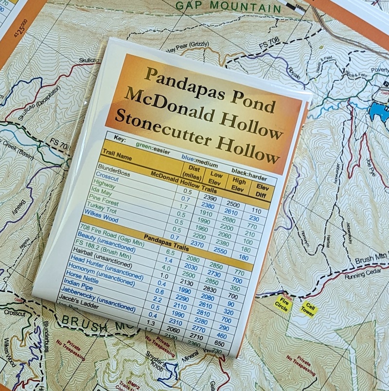
11x17 WATERPROOF Map of Pandapas/McDonald/Stonecutter trails:
The map includes the main trails highlighted with different colors, a key detailing the elevation of each trail, parking area locations, and a host of other useful info!
Includes the McDonald Hollow and Stonecutter Hollow trail systems on the south side of Brush Mountain.
Here are high-resolution versions of the map:
North side
,
South side
,
Last update: May-2026
$20
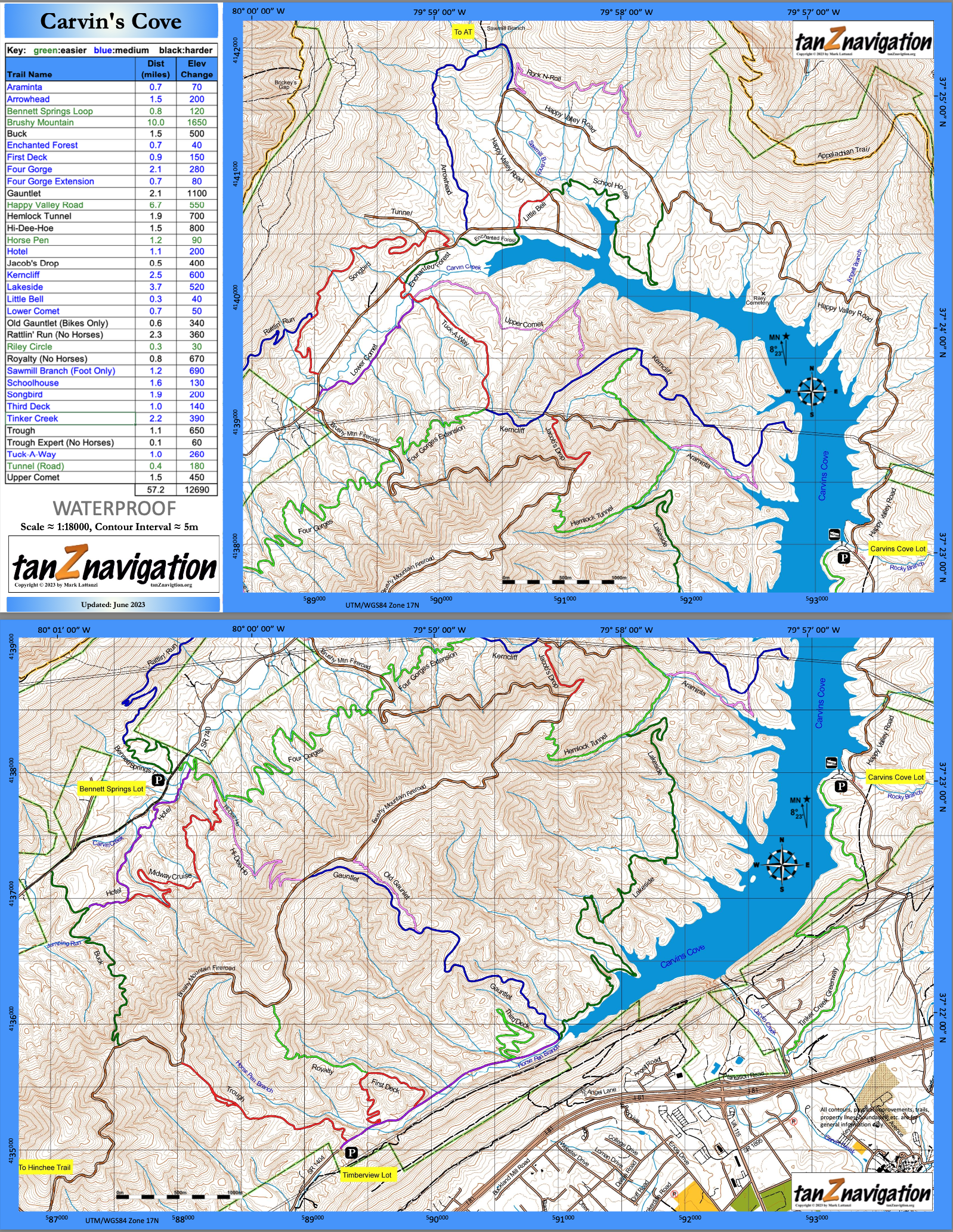
11x17 WATERPROOF Map of Carvin's Cove trails:
The map includes the main trails highlighted with different colors, a key detailing the elevation of each trail, parking area locations, and a host of other useful info!
Here are high-resolution versions of the map:
North side
,
South side
,
Last update: Jun-2023
$20
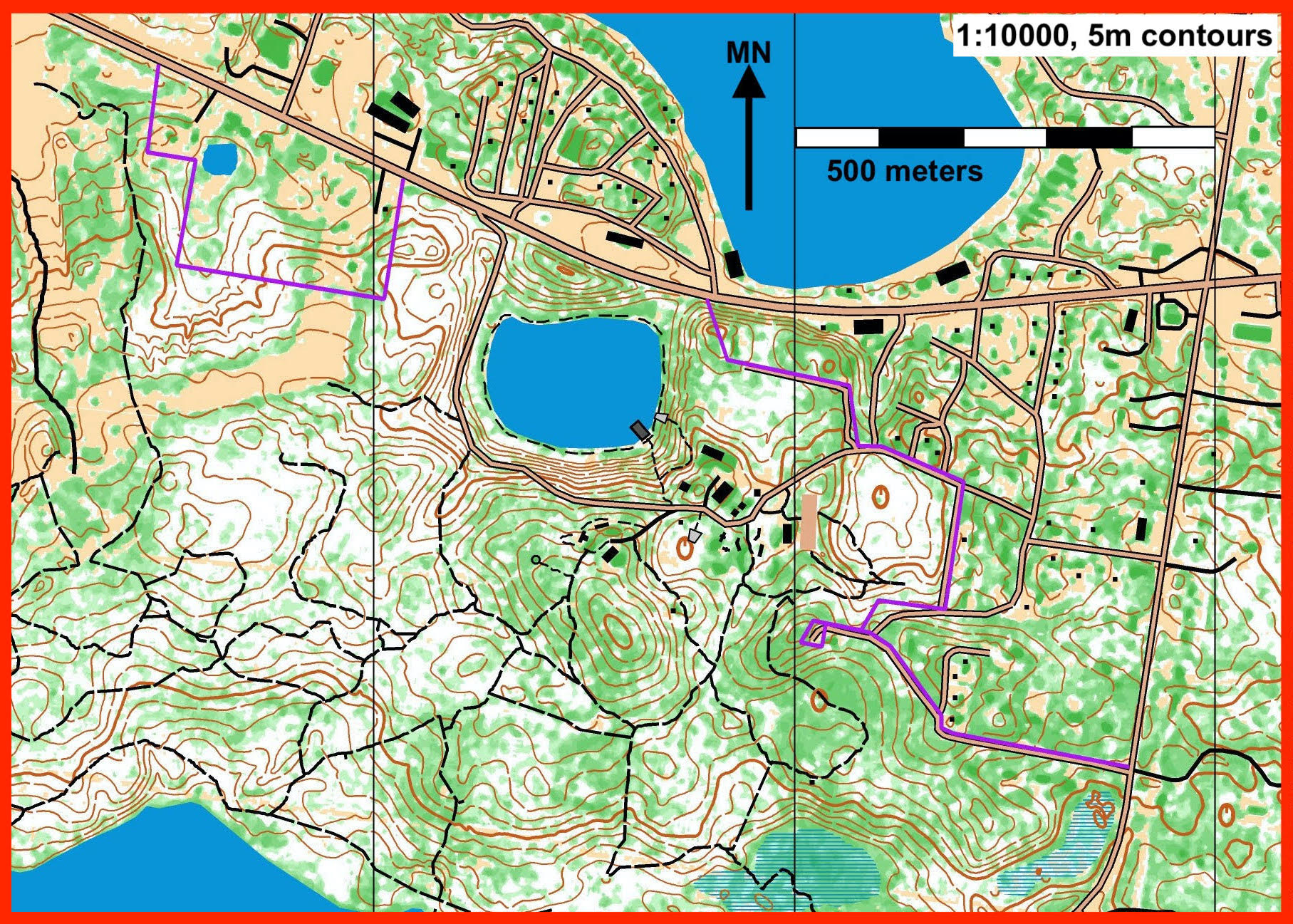
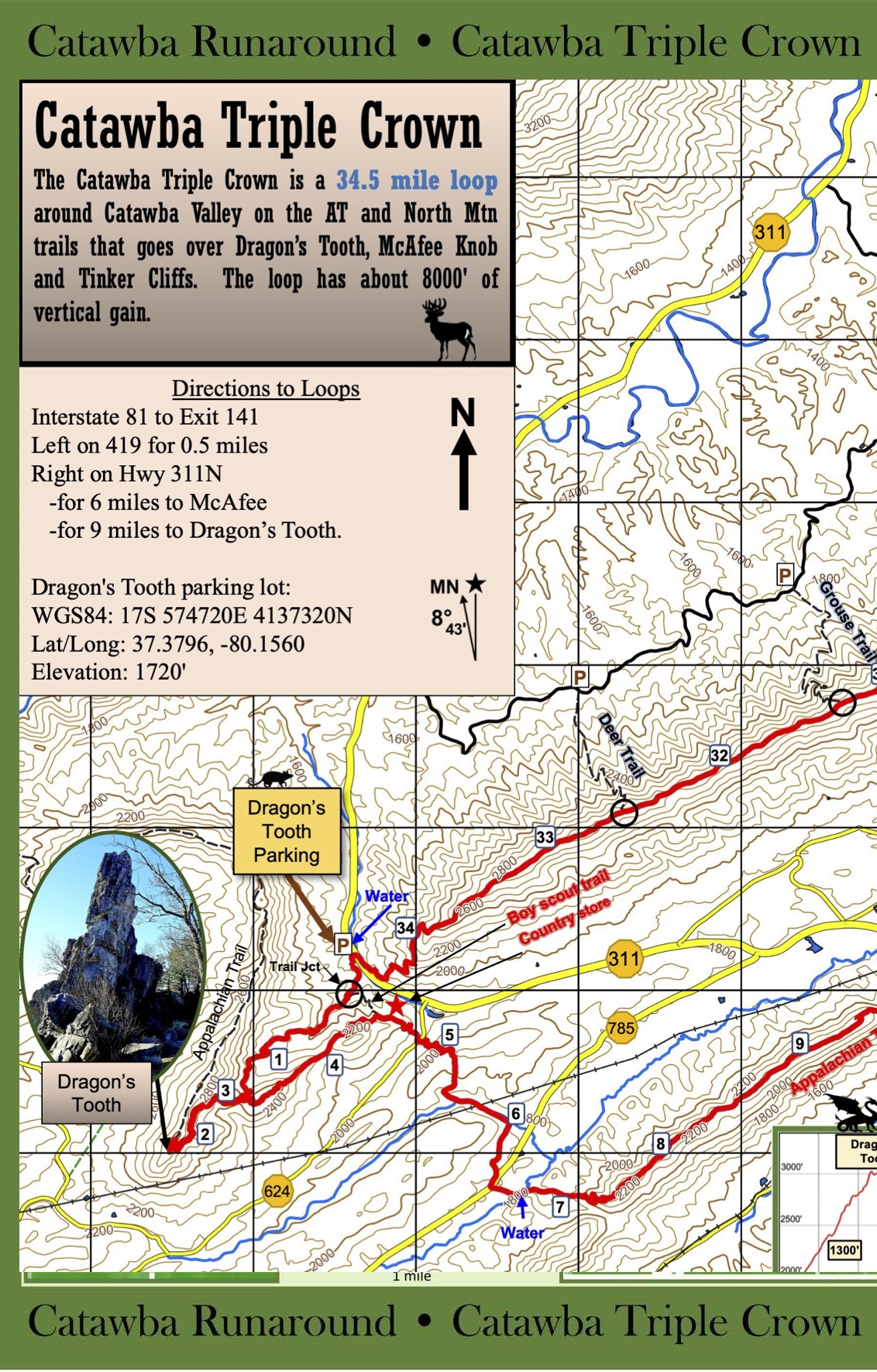
11x17 WATERPROOF Map of Catawba Triple Crown:
11x17 inch waterproof topo map of the Catawba Triple Crown (34 miles). The map includes the main trails highlighted with mile markers, an elevation profile, most of the roads and other trails in the area, shelters, water sources, and a host of other useful info! Suitable for
use on the trail
and for
framing
.
Here's a
high resolution version
that you can download and print yourself for free.
$20
11x17 WATERPROOF Map of Frozen Head State Park:
The map includes the main park trails colored with their respective blaze colors, a vegetation layer, and a cliff/rock layer. It also details some of the point features around the park: campsites, signs, mines, etc. The map has a scale of 1:25000, a contour interval of 40ft, and is oriented to magnetic north.
The map is meant to be an overview map of the Frozenhead area, and should NOT be used as a replacement map for the Barkley marathons.The scale, interval, and orientation are DIFFERENT from the Frozenhead park map.
Here are low-resolution versions of the map:
North side
,
South side
,
Last update: Apr-2025
$20
Orienteering Flag:
12x12x12in nylon orienteering flag with tanZ logo on all three sides. Please order in multiples of FIVE (5). $10 shipping will be added to all orders.
$3.95
Return to Store Front
Keep Shopping
View Cart
Email Me